It took a bit of doing, but I managed to elevate all but the last 6 feet of the spline that makes up the eastern slope. I had to stop because I had used up all the sockets and crosspieces I made. Couldn't make more 'cause I ran out of 3/4" I.D. PVC pipe. Had to go to Lowes and spend $2.02 for another 10 feet of the stuff. Outrageous! :-)
 |
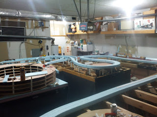
| Eastern Slope Roadbed |
Got off on the wrong foot. I made the mistake of working on the eastbound roadbed first. When I stopped at Horseshoe I went back up to Gallitzin and worked back down on the westbound spline. When I got to the Slide the two splines were at the same elevation. Not supposed to be that way. It took me a while but I figured out that the westbound roadbed was starting an inch or so higher than it should have been. Had to do with the approach level of the helix. The two splines are supposed to be at the same level as they approach the helix. I had to drop the westbound roadbed and make it level with the eastbound...
 |
| Top O' The Hill |
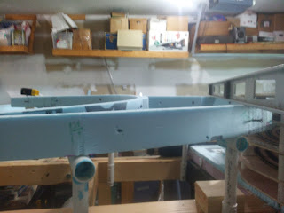
Once I got that fixed things started to fall into place. I placed all the spanners, blocks and sockets based on the "mileposts" marked on the spline itself. I then inserted the uprights. It was a bit of work, especially at SF where I had to keep moving to different sides of the layout to reach the support locations.
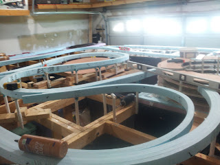 |
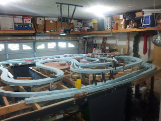
| Gallitzin Helper Loop |
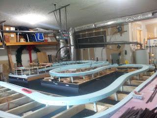
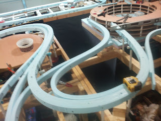
There was a lot of adjusting on the westbound spline. I dropped at about 1.5% from Gallitzin all the way to Horseshoe. Took a while to get it the way I thought it should be. Once I had the "westward" spline I had to redo the elevation on the eastbound spline. In the photos you might be able to see that it's higher than the spline in the foreground (westbound). The helper loop actually runs uphill from UN to AR. I brought the eastbound spline off the top of the helix at the same grade as the spiral for a foot or so. Then I ran it level for a foot. After that it plunged. Can't tell the percentage, but it is better than 1.5%, maybe 2% or so. Since the traffic on this grade is downhill it should work okay. The real Pennsy did, so I'm optimistic. The eastbound tracks on the All East level out with the westbound at McGinley's curve...
 |
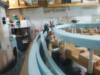
| "The Slide" As Seen From McGinley's Curve |
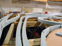
Above McGinley's, passing through Bennington and following Sugar Run things get pretty interesting. After piercing Tunnel Hill the eastbound right of way crosses the New Portage branch on a steel girder bridge. That track connects to the westbound main. There is also a connection from the eastbound mains to the branch. There are quite a number of splines in this area. One for the eastbound main with one each for the westbound tracks. There's another two for the branch that merge as the roadbed heads off the benchwork...
 |
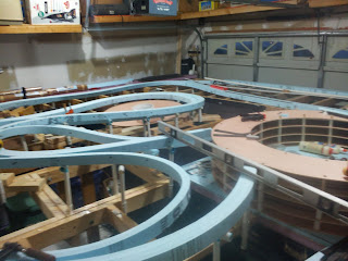
| Bennington's Five Splines |
On the track plan the branch stops at the aisle. When I was actually constructing the splines for the branch I realized there was enough space to route it all the way over to the helix. It occurred to me I might be able to create a "working" branch. Although I left it that way for now, I'm not sure I want to go this route. Not even sure how I could pull it off.
As I was saying, The two mains level out above Horseshoe as they round McGinley's From that point on the grade on both is 1.5% all the way down to the helper station at SLOPE. There is still some support work to be done between McGarvey's and SLOPE in the form of crosspieces for the "smokejacks".
 |
| Horseshoe Curve as Seen From Wikes Curve |
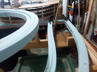
The spline is flexible enough to allow adjustments. One of the first things I did was move the westbound tracks further away from Spruce Creek and Homer. The former 3" horizontal separation is now more like 6"...
 |
| Spruce Creek/Gallitzin Before |
 |
| Spruce Creek/Gallitzin Now |
 |
| Homer Before |
 |
| Homer Now |
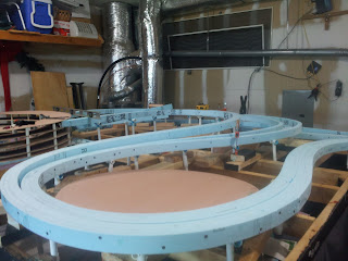
All in all, it's looking better than I hoped. I seriously want to lay down track and get some trains running again, but I'll spend a little bit of time "tuning" the grade. Also have to work out whether or not the Glen White/Altoona Northern scenario is still workable. For now, just some more photos...
 |
| East Slope From East Side of Layout |
 |
| From Brickyard Looking Towards Bennington |
 |
| From Spruce Creek Looking Towards Wikes Curve |
That's about it for this edition...
Regards,
Frank Musick
Chief Cook and Bottle Washer
 |
| Allegheny Eastern Railroad |


No comments:
Post a Comment