Monday, January 30, 2012

Altoona Expands

Altoona & Logan Valley
Since I had used up all the code 55 track available I was unable to continue with the branches and yard. I broke down and purchased some code 80 flex track and began to lay out the Altoona & Logan Valley tracks. I felt I might get away with using the oversize rail. Since the track will be buried in the street, the only visible portion of the code 80 would be the rail head. I removed the Tomix track I was experimenting with and created an elongated loop from 17th Street in Altoona to a point just shy of Juniata. I tucked a return loop into the reverse curve at Millers. This return loop made it very clear that there still wasn't enough room for the Altoona section of the layout, despite the extra foot or so added over the bookcase.

So I started to wonder if the mainline between Wikes and McCanns could be shifted over to allow more room in Altoona. Realigning the mainline yet again is not as big an issue as it sounds. Elevating the mainline between ALTO and Horseshoe Curve is one of the next phases in the project. Moving the tracks a bit to the "north" can be done during the elevation.

Updated Track Plan
Apparently, change begets change. I had been looking over the Gallitzin area on topographic maps and realized I wasn't satisfied with my version. I started doodling on a copy of the trackplan. After relocating the trackage thru The Curve, I reworked Bennington and Gallitzin to look a bit more like the real thing. Moving the New Portage tunnel closer together with the twin bores opened a lot of space in that corner. I revised the New Portage branch to take advantage of this. I used some artist license on the westbound connection. Instead of running it from the east portal like it should, it branches off at Gallitzin on the wrong side of Tunnel Hill. Taking that liberty allows me to hold a longer train on the "Hollidaysburg" loop.

I also decided to keep the connection to the Kittaning Run Railroad at Bakers Run at the east side of Horseshoe. Since the KRRR was a common carrier before it's abandonment it seemed to fit into the interchange scheme of the other branches. Once again a touch of artistic license is in use. According to the minutes of Congressional hearings in 1915 both the Glenwhite and Kittanning Run lines were expensive to operate. Neither one of them would have survived to the time period modeled on the Allegheny Eastern. Fortunately, model railroading is not affected by the foibles of finance and the two lines struggle on to the early 1950s.

Scenery Sketch
I've also been sketching up some idea of what the scenery might look like. At one point I stopped and thought, "What was I thinking?". You can see from the sketch at left that the scenery at Gallitzin covers a lot of real estate in N scale. What's more the Altoona section of the layout is about twenty feet long. If you take the time to count the streets running "north" of the tracks that's about 20 city blocks! True, most of the buildings will be flats or backdrop painting, but that's still a lot of urban scenery. Fortunately Altoona is only two or three blocks wide at the 17th Street end. My original idea was to create a backdrop showing the Juniata shop complex. The addition of the Altoona & Logan Valley trackage pushed that out the plan. The complex will not appear where it's supposed to. It's been relocated to the aisle side of the yard, which means I don't even have to paint it on a backdrop.

Serendipity stepped in at Antis/Gallitzin. The overpass there is the perfect parting line for the two areas. Due to there locations at the extreme ends of the layout main lines Gallitzin Road (Gallitzin) and Lower Riggles Gap Road (Antis) could be combined without some crazy scenery trick. My maps and track charts show that  the mainline crosses the Little Juniata River between Antis and Bellwood so I'm adding that feature into the scenery at this point. It won't be the scene divider that the helix would have been, but it will work.

Like always, I won't get a true picture of how this all can work until I actually start mocking up some scenery. That won't start until after the grades are created.

Thursday, January 26, 2012

Going Up!

Allegheny Eastern Plan, 1/25/2012
I've decided to forego the helix. The "real estate" the beast would consume could be put to better use. Besides, I save hundreds of dollars in track. In its place will be a lot of switching and interchange.

Interconnections
Omitting the helix also means some changes to the grades. In the plan on the left I have marked the elevation at key "mile markers" ( I told you they would come in handy). The west bound grade starts at ALTO at "mile post" 0 at 0" elevation (about 51" above the floor) and climbs at 1.3% to "milepost" 20 where it reaches the maximum elevation of 3" (40 scale feet). It then begins a 1.5% descent into Gallitzin reaching the bottom at "mile post" 39 (westbound) and "milepost" 44 eastbound. I'm bending reality here, the climb actually tops out at the tunnels. Without the helix this is the only way to run back to the 0" elevation at Altoona. Sacrificing the last half of the grade and the helix presents some other opportunities.

On the right is a detail of the area where the helix would have been located. Instead I have drawn in a series of interconnections.
Red = PRR sidings or secondary track
Purple = Altoona Northern
Blue = Altoona & Logan Valley
Green = Glenwhite Coal & Lumber Co.
Brown = Kittanning Run Railroad

The three PRR sidings into the area include two tracks that ran to coke ovens back in the day. Both are located around Gallitzin. The third siding runs to the A&LV power house in East Altoona. Notice that the Altoona Northern and A&LV tracks interchange. Although I could find no evidence that this actually happened, I bent the rules a tad. The interchange will provide an excuse to run boxcab motors and freight under the wire. The Altoona Northern / Glenwhite loop remains pretty much the same except for the introduction of a small yard / passing siding. I drew a second Glenwhite connection that once existed (the wye at "milepost" 22) and also show the connection for the Kittaning Run Railroad (abandoned about 1914) on the east side of Horseshoe Curve. To include these two connections requires that most of the other tracks be elevated to about 1.5" to keep the grades to a minimum. I don't mind elevating the area as I think it would create some scenic interest, but I think the extra connections at The Curve might be two too many.

So much for reviewing the plans. Time to show some video of the "new and improved" Allegheny Eastern in action. The video follows the mainline west from East Altoona to Gallitzin. Please forgive the quality of the video, I'm still learning to use the camera...
 
In the first segment we catch a pair of  eastbound BF16 sharks as they pass the engine terminal at East Altoona on Track 1 A westbound freight blasts by on Track 3. The mainline splits in two at this point as it passes through and around the yard. Next, a Shay pushes a pair of empty hoppers to the Altoona Northern / PRR interchange at Juniata. Our cameraman switches to an aerial view to get a wider angle on freight action at Juniata with Kittanning visible in the foreground. Then we're looking west towards the area of Altoona Station where the mains come back together after passing the yard.. Following the westbound freight to Wikes we catch three freights rounding the curve as an eastbound passenger passes on Track 2. Then the camera moves to The Curve, looking east towards Kittanning as several freights make their way past Kittanning Point in both directions. Giant Tape Measure will be replaced by K4s #1361 in 1957, about eight years from now. A little farther west the camera catches the Glenwhite Shay dropping off two loaded gondolas at Kittaning Point as the Great Wreath hangs in the sky. An aerial view of Burgoon Run shows the Glenwhite Shay idling on the siding as two eastbound freights rumble by. The scene switches to McCains Curve looking towards Horseshoe as an L1s barrels west on Track 3. A second westbound, hauled by an AS16m follows on Track 4 while a short eastbound passenger train drifts down track 3 towards Altoona. At Bennington a K4s holds on the New Portage branch while westbound traffic passes on the main. Eastbound traffic can be seen heading downgrade in the background.  A wider view shows the arrangement of tracks approaching the tunnels and a load of empties heading east. The camera drops down so we can watch the train cross the New Portage bridge. A wider view of trains entering and exiting the three tunnels. That westbound local from Hollidaysburg will take the westbouund main once the controller as SF tower gives the go ahead. We are on the top side of Tunnel Hill now as a westbound freight exits the west portal of Allegheny Tunnel. A second westbound follows soon after thru Gallitzin Tunnel.   Finally, some shots Altoona & Logan Valley cars passing on 10th Avenue and a look at the 3" radius loop at 17th Street. The final scenes show how well the Bachmann PCCs can run on such a tight curve, including a few seconds of open throttle. I never suspected they could negotiate these curves at high speeds! I usually run the trolley's at a more sedate pace..

Saturday, January 21, 2012

Conundrum!

Allegheny Eastern Track Plan Jan 20, 2012
I updated the track plan to reflect all the recent changes though I still have to figure out the track ladders in Altoona Yard. I've been using the printed drawing to sketch some scenery, signal and block locations and other ideas. Doing so has led me to another conundrum.

Gallitzin Sidings
Up until this point the plan was to install a two level helix under Gallitzin so I could raise the entire area six inches. As I was researching scenery details from old topographic maps I learned that there used to be additional sidings in the Gallitzin area. Near as I can tell, they all served coke ovens. This was pretty common way back when. The branches at Kittaning point also served coke ovens as well as mines. I'm not sure I'm going to model the ovens, but I definitely want to include the sidings. One of the sidings was off the eastbound main coming into Gallitzin. This will give me and excuse to fill that extra space that now exists after the re-alignment. Another siding was also off the eastbound main just past the New Portage bridge. This siding was double ended. Two other sidings were on the westbound mains. One directly east of the New Portage connection and the other at the west portal of the Gallitzin bore.

Adding these sidings creates more traffic for the local freights. The siding on the east side of Gallitzin will serve a team track instead of coke ovens so that almost any kind of freight car can be spotted there. The two other siding will actually connect into the Altoona Northern / Glenwhite loop and handle all kinds of traffic, including coke. All of that traffic will be "inferred" since very few, if any, actual industries will be modeled along thos tracks. The double ended siding east of New Portage will be the only track where actual coke ovens will be modeled.

Altoona Northern Connections
Meanwhile back at Altoona research has shown that the Altoona Northern presents more opportunities for switching. Besides the interchange with the Pennsy at Juniata, it appears that the A&M also connected to the Altoona & Logan Valley about 9 blocks west of the PRR interchange. I don't know what the actual situation was but I know what it will be on the Allegheny Eastern. The A&N exchanges freight with the traction line. This means box motors hauling freight cars through  the streets of Altoona. The freight will originate from industries on the the A&N as well as the Pennsylvania. It also means that the A&N exchanges passengers with the A&LV. Trolley passengers bound for Dougherty, Highland Park and Wopsononock can take the A&N.

Altoona & Logan Valley
Extending the Altoona & Logan Valley to East Altoona will require some modification of the engine terminal. Since the workbench sits directly under this area there is a possibility of widening the benchwork at the roundhouse. I want to add a 1 1/2" extension on most of the layout edges because there are too many places where track is right on the edge. The A&LV extension would be part of that revision. I could also lay A&LV tracks towards Hollidaysburg, running them up the length of the yard past Red Bridge.

I made a list of what "branch" generates what traffic and there is a lot of variety. The Altoona Northern will handle passengers, coal loads, freight of all kinds and coke. There will be plenty of empties to return. Glenwhite Coal & Lumber will ship coal, finished lumber, coke, mine supplies and heavy machinery and, of course, more empties. The sidings at Gallitzin will handle coke and general freight of all kinds to the team track. Finally, the Altoona & Logan Valley will handle passengers and local freight.

All of this seems a fair trade for the scenery and "staging" possilbilities of the helix. I can provide scenery below track level by just elevating Horseshoe Curve. In that case the tracks to Gallitzin will actually be downhill. I'm thinking I can pull some magic by creating the illusion that they aren't.

Have to lay some of these ideas out in mock-up and see what it all looks like.

Wednesday, January 18, 2012

Various & Sundrie

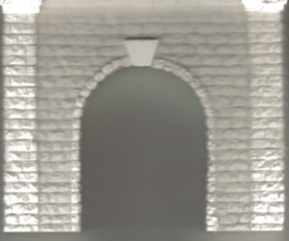
Scan of Tunnel Portal
Now that trains are running again I started working on some details. First up were the bores through Tunnel Hill. I used Woodland Scenic cast stone portals. They look the most like the Pennsy portals I remember around Philadelphia. I took one of the castings and scanned it into the program Paint Shop Pro that I use for graphics. I then copied a section of the scanned stone work to a new image to create a graphic representation of the inside of the tunnel. I pasted the copy several times until I had a six inch long section of tunnel wall. Using some of the image manipulation tools I created "shadows" in different shades ranging into black. The idea was to mimic the inside of the tunnel and the graduating darkness you would see further away from the entrance.

Tunnel Interior Wall
Since my tunnels are only about six inches long I had to compress the effect. Once I thought it looked reasonably convincing I printed the completed wall section out on card stock using a laser printer. I then cut out the wall sections and glued them to heavier cardboard.

Assembled Tunnel


I fastened the "walls" to the portals using basswood  blocks and tacky glue, making sure the walls were flush with the portal openings.  I went the "good enough" route and didn't worry too much about lining up the courses of stone. I'm trusting that as long as the train looks like its entering a tunnel the viewers imagination will fill out the details. I also did not create "roofs" for the tunnels. I wanted to be able to access the inside "just in case".

The twin bores, Gallitzin and Allegheny, just sit on the styrofoam roadbed, but the New Portage Tunnel is located where the eastbound mains climb toward the New Portage bridge. I had to construct an elevated base for the tunnel to sit on. I cut several pieces of scrap lumber to get the appropriate height and glued them with tacky glue.

East Portage Tunnel, East Portal
To the right is the east portal of the New Portage bore. The photo was taken from the eastbound track of the New Portage branch. The double tracks of the eastward main line bear off to the right.The overall effect is pretty much what I was hoping for. Even with the tunnels open to the ceiling lights they still appear to get darker towards the center. All in all, I think they'll look pretty good when everything is painted up and weathered.

Just adding these few details made a big difference in the feel of the Tunnel Hill area. It's getting easier to imagine the finished product.


Signage

There are several other items I've added that are what might be called "operational details". I made up small signs for the sides of the benchwork showing the name of each location and other pertinent information. On the left is a photo of the signs for Gallitzin. The location name is made to look like a PRR station sign. There is also a sign for the tower designation UN which controlled the westbound interlocking. I've yet to add AR, the tower that controlled the eastbound interlocking. I've also posted speed limit signs. Starting at UN headed west the passenger speed limit is 70 mph. Freight trains are limited to 35 mph, probably due to the fact that the route is all downhill into Johnstown. Don't want any runaways careening through the communities on the west slope. I still have to add speed limit signs for east bound trains. I haven't quite figured out how I want to show all this information. I'll probably have a column of signs for eastbound and a separate column for westbound. These signs are black & white. The finished signs will be color.

"Mile" Markers
 I also went around the layout with a 100 foot reel type tape measure and measured the main line. The flexible tape allowed me to follow the center of the track line, including the curves. I then marked the styrofoam roadbed at every foot. I found out that the eastbound mainline is 70 feet long, about 2.2 scale miles. The westbound mainline is shorter. At 63.5 feet or thereabouts, it scales out to 1.9 miles. Multiply those numbers by two and you get a total of 257 feet of mainline, just over 8 scale miles.

Beside learning the approximate length of my mainlines, the measurements will help in creating grades when the helix is installed and the tracks are elevated. It will also help in locating scenic details and other features. I'm playing with the idea of using the measurements in some sort of mile marker scheme. Haven't worked out the details yet.

Finally, I may have discovered a new method of creating spline roadbed. I had experimented with splines in an earlier incarnation of the All East but decided against it for a number of reasons. When I was creating the grade for the the New Portage bridge, however, I tripped over another way of accomplishing this. I would have missed it entirely had it not been for a conversation with my wife.

Spline Roadbed
Most of the time we work with styrofoam (or wood for that matter) we use what is called the "cookie cutter" method to build the sub-roadbed. No matter what you start with you end up with the general shape of the track plan in  generally horizontal pieces that the ballast board sits on. When I built the elevated portion of the eastbound mains I used vertical pieces of 1/2" thick styrofoam. I found that two pieces glued together was exactly the correct width to hold the ballast strip. I created the grade by cutting the styrofoam in long triangular strips, gluing them together and curving them as required. I was able to curve the stuff quite easily without breakage because of the thinness of the foam and the wide curves on the Allegheny Eastern. Once the glue set I had a strong light roadbed. I really didn't think too much about it at the time, but I had basically created a spline to carry the track up to the bridge and back down. What's more, I didn't have to create any supports. The grade was built into thhe triangular shapes and they could be glued directly to the tabletop. For the rest of the layout I had originally envisioned the elevated track and the helix being made via a variation of the old school "cookie cutter" method. Using the same construction as the New Portage grade, no cookie cutting is required. The entire thing, including the helix, can be built the same way. By cutting long triangular strips out of a 4' x 8' sheet of 1/2" styrofoam I can create spline road bed to support all the elevated track.
Allegheny Eastern Revised Track Plan, January 2012

1% Grade Elevation
I didn't think to take any photos of the actual grade construction so I made up some rough drawings. The Allegheny summit is at the west portal of the tunnels in Gallitzin. According to the measurements marked on the layout that's about 39 feet from ALTO tower (see track plan above). To create the a roadbed from ALTO to Gallitzin with a 1% grade would require eight triangular pieces  (four tracks) of styrofoam 468" long. Each piece would be 4.68" tall at the highest end of the triangle.

1.3% Grade Elevation
To reach the planned 6 inch elevation at Gallitzin would require 600" of spline. 600" is 50 feet, which would put the summit just pass ANTIS tower in East Altoona.. Not what I'm after. Going with a 1.3% grade would allow the track to rise to 6.084" while still maintaining the required length.

Spline Parts
Of course the spline would have to pieced together. You need 5 pieces 8 feet long to make up the first "spline". The elevation of each piece would start where the last one stopped off, going from 0" all the way up to 6". You would need 8 copies of this first spline and its parts. Once all the pieces are cut, you would then build the spline one 8 foot section at a time.
Spline Construction, Rough Sketch
You would need to install a section and let the glue set overnight before working on the next. Going too fast would probably end up in disaster. The curved sections will want to spring back to straight and things would be flying all over the place.

This method really lends itself to table top layouts like the Allegheny Eastern, especially if the top of the table is also foam. The splines are cheap to make. A 4' x 8' sheet of 1/2" extruded blue foam costs about $12 at the home improvement store. I get mine at Lowes. This is quite a bit cheaper than 2" thick extruded foam or 3/4" plywood normally used for layouts. It can be cut with a utility knife or razor blade. No saws required.

Thursday, January 12, 2012

Resuming Operations

Heavy Traffic
Busy day at the top of The Hill. The westbound local from Hollidaysburg holds on the New Portage branch as a westbound passenger train clears the FS interlocking. An L2 helper is on the loop to return to Altoona. The helper has just finished assisting a westbound mixed freight.  Above on the eastward mains a passenger train headed to Philadelphia overtakes a coal train bound for Altoona yard. Since Tunnel Hill is still to be constructed both SF and Gallitzin are visible to the camera. Helper loop was unfinished when the photo was taken. The turnout and track to complete the connection to the eastward mains is now installed.


New Portage Bridge
Local from Hollidaysburg passes under eastward mainline as an L1s helper drifts down to Altoona. AP20 is heading up a Philadelphia bound passenger train on the Track 2. Bridges are cobbled together from Atlas viaducts and girder kits.


Bennington
Another L1s with a local freight climbs west while the passenger train drops down the grade at "Benny".  The tracks are separated vertically and the eastward mains are dropping down a 1.5% grade from the New Portage bridge to just west of Horseshoe Curve.Modeling in N scale on a larger layout allows you to put some distance between scenes. Gallitzin is almost fifteen feet west from this point, a bit under half a scale mile. Altoona lies about a scale mile in the other direction.


Glen White Interchange
At left the Glen White Shay  trundles off to the mines with two empties that a local freight has just dropped. The Glen White track runs along Burgoon Run and disappears behind Kittaning Point. When the cars are filled the Shay will drop them off to be picked up by another local heading east to Altoona.
Altoona Northern Interchange
At right an Altoona Northern crew drops a couple of empties on the interchange track in Altoona. The AN interchange is on the passenger mains and Pennsy switchers have to perform a tricky bit of maneuvering to pickup and set out cars here.


Altoona Yard
EMD demonstrator switches cars in the westbound yard as two freights "meet" on the freight main. Passenger main is just visible beyond tank car. Pennsy's multiple track mainline allows trains to meet without stopping. First of the five eastbound yard tracks is visible at the left hand side of the photo.

Realignment

East Altoona and Yard
The realignment is complete. All the main lines have been re-positioned with  wider curves and a few other "enhancements". Altoona now has sweeping curves at each end. The East Altoona engine terminal is beginning to take shape. The new diesel house and fuel facilities for steam and diesel are being laid out in the corner of the layout to the left of the roundhouse. Cabin cars and MOW equipment will also be stored in this area.


Altoona
The city of Altoona itself is in the same general location but the area is a bit larger due to the more generous radius on the curves. The Altoona freight house and related trackage has yet to be developed.


Horseshoe Curve
Horesehoe Curve has been widened and the Glen White Mining & Logging Co tracks have been installed on the Burgoon Run side (west) of the curve. The Glen White trackage now loops back into East Altoona as the Altoona Northern where it connects to the passenger mains.


Bennington
The top of the hill has changed dramatically. The westward mains are now separated for a longer distance and set farther apart. The New Portage branch has been added and the eastward mains are now elevated to run over the branch.


Gallitzin
Gallitzin has also changed quite a bit. The helper loop is now further east and there is a lot more space on this corner of the layout, enough for several sidings to serve industries or a mine.


Antis
The mainline between Gallitzin and East Altoona has been extended and now provides enough room for an interlocking. This area has been named Antis and will be the location of the helix when that is completed and installed. Gallitzin will be raised to allow the helix to pass underneath. The mains at this location will be realigned to spiral into the upper level of the helix.

Saturday, January 7, 2012

New Portage

One of the "features" of the redesigned Tunnel Hill area is the bridge that carries the eastward mains over the New Portage branch. The branch was originally part of the New Portage Railroad constructed in the 1850's by the state of Pennsylvania. At that time the Allegheny Portage Railroad used incline planes with tow ropes to surmount the Alleghenies. The New Portage Railroad bypassed the inclines and provided an rail route over the summit. The Pennsylvania purchased the New Portage and used it until its own route over Horseshoe Curve was completed. The New Portage was abandoned in 1857. The right of way was reopened in 1904 as a bypass for freight traffic. The route had its own 180 degree curve similar to Horseshoe, called Muleshoe. The branch was abandoned for the second time in 1981, this time by Consolidated Rail.

New Portage Branch
Part of the latest revision to the Allegheny Eastern is  the inclusion of the New Portage branch (or at least the suggestion of it). This required the construction of a set of stone arch and girder bridges and a grade to get the eastward trains over the branch. In the photo to the left a class AS16 hauls a MOW car on the branch while a EP22 hauls a local the wrong way on the eastward main. Nothing is running right now, the shot is staged. I was checking clearances under the bridge with the Alco and the boxcar. Vertical tolerance is tight to keep eastward grade down to 1.5%.
Eastward Grade Roadbed


The grade itself is constructed of laminated strips of extruded foam covered with ballast strip. The entire assembly is held together with tacky glue and then weighted and clamped into position until the glue sets. This is the eastward freight main. The ballast strip directly adjacent on the right is the location of the eastward passenger main which is now in place and setting up. The the eastward mains are carried over the branch by two separate but identical stone and steel bridges. The real bridge was a single concrete span and quite a bit different. I used some Atlas viaduct and bridge kits I had on hand and got creative.

Wide View of Tunnel Hill Area
The wide view on the left shows the progress on the revised area. The branch runs under the eastward mains and connects to the westward mains via a wye switch. The second eastward main runs adjacent to the first with a slight separation at the bridges. Beyond the wye switch will be the west portals of the twin tunnels. The curved foam piece just beyond that is a template for the helper loop. It will run uphill to join the eastward mains where the white box sits. Way off to the far left is the future location of the Gallitzin "industrial area". Between the helper loop and the branch will be Tunnel Hill and the town of Gallitzin itself.

As I mentioned earlier the eastward freight main is in place and I'm waiting for the glue to set up. I hope to complete the grade and install the remainder of the ballast strip for the mainline over the next few days. Track will be laid and there is a good chance trains will be moving again later this week.